This lesson is designed for World Geography teachers to teach standard 3 …
This lesson is designed for World Geography teachers to teach standard 3 about Culture to students. In the end students will be creating a video sharing their culture and showing their understanding of what culture is and what influences it has based on place, religion, etc...
Word Count: 7198 (Note: This resource's metadata has been created automatically by …
Word Count: 7198
(Note: This resource's metadata has been created automatically by reformatting and/or combining the information that the author initially provided as part of a bulk import process.)
Word Count: 9323 (Note: This resource's metadata has been created automatically by …
Word Count: 9323
(Note: This resource's metadata has been created automatically by reformatting and/or combining the information that the author initially provided as part of a bulk import process.)
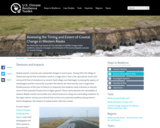
An interactive map based on four decades of satellite images helps residents, …
An interactive map based on four decades of satellite images helps residents, resource managers, and stewards of the land anticipate and plan for coastal change.
This first year Geography textbook takes a holistic approach to Geography by …
This first year Geography textbook takes a holistic approach to Geography by incorporating elements of physical, human and regional geography, as well as bringing in methods and perspectives from spatial information science.. This textbook applies a fundamental geographical approach to understanding our globally changing world by looking at local processes which are linked to larger global processes and events. For example mining and its effects are a global issue and we can see how these unfold in BC. A further example is the recent apology to First Nation peoples on the residential school treatment, as similar events occur in the US, Ireland and Australia. Processes of urbanization, a phenomenon which people all over the globe are experiencing, can be seen in Vancouver with our discussion of the citys development. Geography students, indeed all first year students, need to be able to critically assess their own contexts and environments in order to properly engage with our continually globalizing world.
Cartography is the art and science of graphically representing a geographical area …
Cartography is the art and science of graphically representing a geographical area on a flat surface such as a map. For Indigenous peoples, cartography is more than just topography or mapping locations. For many Indigenous communities, it's about values, culture and traditional understandings.
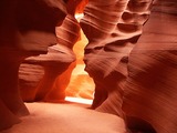
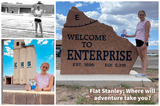
Thumbnail Image Credit: Antelope Canyon, by Meckimac, Creative Commons Attribution-Share Alike 3.0, Navajo Tribal Park, Arizona, USA.Students will learn about the changes in the earth's surface and and how they occur by going on virtual and real fieldtrips, discussing in groups, and sharing with the class. They will showcase their learning by creating a book with photographs and descriptions.
In this video segment, ZOOM guest Cassie takes us on a tour …
In this video segment, ZOOM guest Cassie takes us on a tour of the coral reef near her home in Key Largo, Florida, and points out some of its unique features.
This lesson plan aims at incorporating technology, in this case the Pages …
This lesson plan aims at incorporating technology, in this case the Pages app on iPad, to create pamphlets that demonstrate depth of knowledge of social studies content.
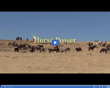
In this episode Discovery Road saddles up for an educational ride through …
In this episode Discovery Road saddles up for an educational ride through the history of the horse in the American West. The show opens with a visit to the Cleone Peterson Eccles Equestrian Center in Mt. Pleasant, Utah. The top-notch facility and indoor arena plus 200 horse stalls accommodate numerous events throughout the year and serves as a training ground for Wasatch Academy students. A stop at Burns Saddlery in Salina, Utah reveals one of the most historic horse related companies in the country. Boots, hats, belts and saddles are just a few of the quality products the business has been making for well over a century. Discovery Road then visits Kanab, Utah for the opening of new horse and hiking trail. The trail is connected to an amazing story of two ranching brothers who succeeded against tough odds to make their ranch work years ago. The role of horses in the western movies is then explored through the experience of one man in Kanab who worked with Hollywood to find the best horses for the silver screen. Denny Judd reminisces about working with movie star Dean Martin and others, years ago. The Discovery Road closing segment is a simple tribute to a Kane County man who spent the last years of his life, giving horse and wagon rides to people. Horse Power is the latest episode in the award winning Discovery Road series.
This lesson plan gives students a chance to learn about a country …
This lesson plan gives students a chance to learn about a country of their choice by accessing two databases to pull information from: Culturegrams and World Book Online. They are given a list of topics that need to be included in their project (which also serves as their assessment). They will be using Adobe Express to create a video highlighting their country, giving space for the topics they've researched.For cover image:Photo by Vlada Karpovich: https://www.pexels.com/photo/person-opening-a-map-on-the-floor-7368277/photo resource Lesson plan idea:https://www.uen.org/lessonplan/view/42845
Essentials of Geographic Information Systems integrates key concepts behind the technology with …
Essentials of Geographic Information Systems integrates key concepts behind the technology with practical concerns and real-world applications. Recognizing that many potential GIS users are nonspecialists or may only need a few maps, this book is designed to be accessible, pragmatic, and concise. Essentials of Geographic Information Systems also illustrates how GIS is used to ask questions, inform choices, and guide policy. From the melting of the polar ice caps to privacy issues associated with mapping, this book provides a gentle, yet substantive, introduction to the use and application of digital maps, mapping, and GIS.
Word Count: 55656 (Note: This resource's metadata has been created automatically by …
Word Count: 55656
(Note: This resource's metadata has been created automatically by reformatting and/or combining the information that the author initially provided as part of a bulk import process.)
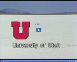
The significance of "Program #1: Salt Lake Empire" is discussed in this …
The significance of "Program #1: Salt Lake Empire" is discussed in this full program from the 22-part video series THE GEOGRAPHY OF UTAH, conceived and written by Albert L. Fisher, PhD (University of Utah) in the early 1980s. Program One examines the mistaken interpretation of Utah as a remote and isolated locale. The significance of the Salt Lake Empire as an economic, social, cultural, religious, and health service center is identified and explored. The entire GEOGRAPHY OF UTAH series encompasses the political, cultural, historical and sociological geography of the state of Utah. It describes the activities, the land and the people. Much of the video material was videotaped on location throughout the state of Utah, giving the student and interested viewer valuable field trip experiences. You will find that even though the series was produced several decades ago, Utah's issues and its landforms have virtually remained the same, although many of the players have changed.
The significance of "Program #2: Utah Landforms, Part 1" is discussed in …
The significance of "Program #2: Utah Landforms, Part 1" is discussed in this full program from the 22-part video series THE GEOGRAPHY OF UTAH, conceived and written by Albert L. Fisher, PhD (University of Utah) in the early 1980s. The two programs on landforms describe the three major physiographic provinces: The Rocky Mountain province, containing the Uintah and Wasatch mountain ranges; the Great Basin province with its mountains, basins, salt deserts, and the Great Salt Lake; and the Colorado Plateau province, containing the high plateaus, the Canyonlands, and the Uintah Basin. Part 1 specifically details the Colorado Plateau and its contribution to the state's economy, beauty, and future growth. The entire GEOGRAPHY OF UTAH series encompasses the political, cultural, historical and sociological geography of the state of Utah. It describes the activities, the land and the people. Much of the video material was videotaped on location throughout the state of Utah, giving the student and interested viewer valuable field trip experiences. You will find that even though the series was produced several decades ago, Utah's issues and its landforms have virtually remained the same, although many of the players have changed.
No restrictions on your remixing, redistributing, or making derivative works. Give credit to the author, as required.
Your remixing, redistributing, or making derivatives works comes with some restrictions, including how it is shared.
Your redistributing comes with some restrictions. Do not remix or make derivative works.
Most restrictive license type. Prohibits most uses, sharing, and any changes.
Copyrighted materials, available under Fair Use and the TEACH Act for US-based educators, or other custom arrangements. Go to the resource provider to see their individual restrictions.