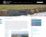
An interactive map based on four decades of satellite images helps residents, …
An interactive map based on four decades of satellite images helps residents, resource managers, and stewards of the land anticipate and plan for coastal change.
This article lists common misconceptions about weathering, erosion, volcanoes, and earthquakes. It …
This article lists common misconceptions about weathering, erosion, volcanoes, and earthquakes. It provides formative assessment probes and information about teaching for conceptual change.
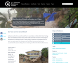
Each winter, massive waves attract surfers and visitors to the North Shore …
Each winter, massive waves attract surfers and visitors to the North Shore of Oahu in Hawaii. Some years, the waves cause severe erosion, and continuing sea level rise will accelerate this issue. Residents and the state are taking steps to preserve homes and beaches.
CK-12 Earth Science For High School covers the study of Earth - …
CK-12 Earth Science For High School covers the study of Earth - its minerals and energy resources, processes inside and on its surface, its past, water, weather and climate, the environment and human actions, and astronomy.
CK-12 Earth Science For Middle School covers the study of Earth - …
CK-12 Earth Science For Middle School covers the study of Earth - its minerals and energy resources, processes inside and on its surface, its past, water, weather and climate, the environment and human actions, and astronomy.
This issue of the free online magazine, Beyond Penguins and Polar Bears, …
This issue of the free online magazine, Beyond Penguins and Polar Bears, explores glaciers, wind, water, and volcanoes and their role in shaping the landscape of the polar regions.
This article provides science content knowledge about forces that shape the Earth's …
This article provides science content knowledge about forces that shape the Earth's surface: erosion by wind, water, and ice, volcanoes, earthquakes, and plate tectonics and how these forces affect Earth's polar regions.
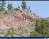
The significance of -- Vertical slip fault at Flaming Gorge -- is …
The significance of -- Vertical slip fault at Flaming Gorge -- is discussed in this media item extracted from the 22-part video series THE GEOGRAPHY OF UTAH, conceived and written by Albert L. Fisher, PhD (University of Utah). The series encompasses the political, cultural, historical and sociological geography of the state of Utah. It describes the activities, the land and the people. Much of the video material was videotaped on location throughout the state of Utah, giving the student and interested viewer valuable field trip experiences.
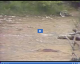
The significance of -- Virgin River moving downstream -- is discussed in …
The significance of -- Virgin River moving downstream -- is discussed in this media item extracted from the 22-part video series THE GEOGRAPHY OF UTAH, conceived and written by Albert L. Fisher, PhD (University of Utah). The series encompasses the political, cultural, historical and sociological geography of the state of Utah. It describes the activities, the land and the people. Much of the video material was videotaped on location throughout the state of Utah, giving the student and interested viewer valuable field trip experiences. === The continuous processes of erosion are greatly accelerated during the flooding that normally occurs several times each year. The Virgin River carries away more than a million tons of material annually. ===
In this video segment adapted from Spanner Films, visit the Alaska Native …
In this video segment adapted from Spanner Films, visit the Alaska Native village of Shishmaref, and learn how an entire town may be forced to relocate because of warmer temperatures, melting sea ice, and coastal erosion.
This video segment adapted from NOVA features the youngest rock formations in …
This video segment adapted from NOVA features the youngest rock formations in the Grand Canyon, lava dams, and how they are subject to the eroding power of water.
This article highlights hands-on or multimedia lesson plans about glaciers. Science lessons …
This article highlights hands-on or multimedia lesson plans about glaciers. Science lessons are paired with suggested literacy lesson plans. All lessons are aligned to national standards.
This article highlights science and literacy lessons to teach elementary students about …
This article highlights science and literacy lessons to teach elementary students about erosion, glaciers, volcanoes, and earthquakes. Links to national standards are included.
This nonfiction article, written for students in grades 4-5, explores the ways …
This nonfiction article, written for students in grades 4-5, explores the ways in which glaciers shape the Earth's land. Modified versions are available for students in younger grades.
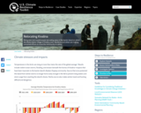
Rising seas and coastal erosion are eating away at the barrier island …
Rising seas and coastal erosion are eating away at the barrier island on which the Alaska Native Village of Kivalina rests. Residents and others are making concerted efforts to move the community to safety.
No restrictions on your remixing, redistributing, or making derivative works. Give credit to the author, as required.
Your remixing, redistributing, or making derivatives works comes with some restrictions, including how it is shared.
Your redistributing comes with some restrictions. Do not remix or make derivative works.
Most restrictive license type. Prohibits most uses, sharing, and any changes.
Copyrighted materials, available under Fair Use and the TEACH Act for US-based educators, or other custom arrangements. Go to the resource provider to see their individual restrictions.