This learning video uses a simple analog setup to explore why earthquakes …
This learning video uses a simple analog setup to explore why earthquakes are so unpredictable. The setup is simple enough that students should be able to assemble and operate it on their own with a teacher's supervision. The teaching approach used in this module is known as the 5E approach, which stands for Engagement, Exploration, Explanation, Elaboration, and Evaluation. Over the course of this lesson, the basic mechanisms that give rise to the behavior of the simple analog system are explained, and further elaboration helps the students to apply their understanding of the analog system to complex fault systems that cause earthquakes
This article lists common misconceptions about weathering, erosion, volcanoes, and earthquakes. It …
This article lists common misconceptions about weathering, erosion, volcanoes, and earthquakes. It provides formative assessment probes and information about teaching for conceptual change.
CK-12 Earth Science For High School covers the study of Earth - …
CK-12 Earth Science For High School covers the study of Earth - its minerals and energy resources, processes inside and on its surface, its past, water, weather and climate, the environment and human actions, and astronomy.
CK-12 Earth Science For Middle School covers the study of Earth - …
CK-12 Earth Science For Middle School covers the study of Earth - its minerals and energy resources, processes inside and on its surface, its past, water, weather and climate, the environment and human actions, and astronomy.
This video segment adapted from NOVA tells the tragic story of two …
This video segment adapted from NOVA tells the tragic story of two Japanese seismologists who disagreed about the threat of earthquakes in the early twentieth century. Today, seismologists in California offer residents a probability of risk that an earthquake might occur.
In this video segment adapted from NOVA, animations are used to show …
In this video segment adapted from NOVA, animations are used to show how the hills around Los Angeles were formed by earthquakes at small thrust faults that extend outward from the larger San Andreas fault.
In this video segment adapted from NOVA, a geologist digs a trench …
In this video segment adapted from NOVA, a geologist digs a trench along the San Andreas Fault to reveal three thousand years of earthquake history. Information from the layers of sediment may help geologists to predict earthquakes.
This video segment adapted from NOVA uses historical illustrations, photographs, and animations …
This video segment adapted from NOVA uses historical illustrations, photographs, and animations to explain how seismographs work, the difference between P and S waves, and the Richter scale.
This article provides science content knowledge about forces that shape the Earth's …
This article provides science content knowledge about forces that shape the Earth's surface: erosion by wind, water, and ice, volcanoes, earthquakes, and plate tectonics and how these forces affect Earth's polar regions.
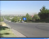
A view of -- Fault line of Wasatch Fault -- is presented …
A view of -- Fault line of Wasatch Fault -- is presented in this media item extracted from the 22-part video series THE GEOGRAPHY OF UTAH, conceived and written by Albert L. Fisher, PhD (University of Utah). The series encompasses the political, cultural, historical and sociological geography of the state of Utah. It describes the activities, the land and the people. Much of the video material was videotaped on location throughout the state of Utah, giving the student and interested viewer valuable field trip experiences.
A view of -- Salt Lake Valley major water supply -- is …
A view of -- Salt Lake Valley major water supply -- is presented in this media item extracted from the 22-part video series THE GEOGRAPHY OF UTAH, conceived and written by Albert L. Fisher, PhD (University of Utah). The series encompasses the political, cultural, historical and sociological geography of the state of Utah. It describes the activities, the land and the people. Much of the video material was videotaped on location throughout the state of Utah, giving the student and interested viewer valuable field trip experiences. === Since these major water supplies cross the Wasatch Fault, a great earthquake could be a serious hazard because water coming into the valley would be cut off. ===
The significance of -- Soil liquification -- is discussed in this media …
The significance of -- Soil liquification -- is discussed in this media item extracted from the 22-part video series THE GEOGRAPHY OF UTAH, conceived and written by Albert L. Fisher, PhD (University of Utah). The series encompasses the political, cultural, historical and sociological geography of the state of Utah. It describes the activities, the land and the people. Much of the video material was videotaped on location throughout the state of Utah, giving the student and interested viewer valuable field trip experiences.
The significance of -- Wasatch Fault -- is discussed in this media …
The significance of -- Wasatch Fault -- is discussed in this media item extracted from the 22-part video series THE GEOGRAPHY OF UTAH, conceived and written by Albert L. Fisher, PhD (University of Utah). The series encompasses the political, cultural, historical and sociological geography of the state of Utah. It describes the activities, the land and the people. Much of the video material was videotaped on location throughout the state of Utah, giving the student and interested viewer valuable field trip experiences. === The Wasatch Fault can be seen below 13th East, by East High School, or along other streets that drop steeply below 13th East. It can also be seen along the homes of the upper avenues above Shriner's Hospital. The fault can also be seen in several rock and gravel pits of North Salt Lake where mining has revealed the fault scarp. ===
This article highlights science and literacy lessons to teach elementary students about …
This article highlights science and literacy lessons to teach elementary students about erosion, glaciers, volcanoes, and earthquakes. Links to national standards are included.
No restrictions on your remixing, redistributing, or making derivative works. Give credit to the author, as required.
Your remixing, redistributing, or making derivatives works comes with some restrictions, including how it is shared.
Your redistributing comes with some restrictions. Do not remix or make derivative works.
Most restrictive license type. Prohibits most uses, sharing, and any changes.
Copyrighted materials, available under Fair Use and the TEACH Act for US-based educators, or other custom arrangements. Go to the resource provider to see their individual restrictions.