This article lists common misconceptions about weathering, erosion, volcanoes, and earthquakes. It …
This article lists common misconceptions about weathering, erosion, volcanoes, and earthquakes. It provides formative assessment probes and information about teaching for conceptual change.
In this video segment adapted from NOVA, scientists search for carbonized remains …
In this video segment adapted from NOVA, scientists search for carbonized remains of plants preserved in lava flows to find out how long it has taken rain forests on Hawaii to regenerate after a volcanic eruption.
CK-12 Earth Science For High School covers the study of Earth - …
CK-12 Earth Science For High School covers the study of Earth - its minerals and energy resources, processes inside and on its surface, its past, water, weather and climate, the environment and human actions, and astronomy.
CK-12 Earth Science For Middle School covers the study of Earth - …
CK-12 Earth Science For Middle School covers the study of Earth - its minerals and energy resources, processes inside and on its surface, its past, water, weather and climate, the environment and human actions, and astronomy.
This issue of the free online magazine, Beyond Penguins and Polar Bears, …
This issue of the free online magazine, Beyond Penguins and Polar Bears, explores glaciers, wind, water, and volcanoes and their role in shaping the landscape of the polar regions.
This article assembles free resources from the Earth's Changing Surface issue of …
This article assembles free resources from the Earth's Changing Surface issue of the Beyond Penguins and Polar Bears cyberzine into a unit outline based on the 5E learning cycle framework. Outlines are provided for Grades K-2 and 3-5.
This article provides science content knowledge about forces that shape the Earth's …
This article provides science content knowledge about forces that shape the Earth's surface: erosion by wind, water, and ice, volcanoes, earthquakes, and plate tectonics and how these forces affect Earth's polar regions.
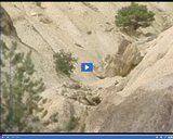
The significance of "Big Rock Candy Mountain" is discussed in this media …
The significance of "Big Rock Candy Mountain" is discussed in this media item extracted from the 22-part video series THE GEOGRAPHY OF UTAH, conceived and written by Albert L. Fisher, PhD (University of Utah). The series encompasses the political, cultural, historical and sociological geography of the state of Utah. It describes the activities, the land and the people. Much of the video material was videotaped on location throughout the state of Utah, giving the student and interested viewer valuable field trip experiences. This formation between Sevier Junction and Cove Fort and south of Marysville is composed of compacted volcanic ash called "tuff."
A view of -- Intrusive volcanism at Mount Ellsworth -- is presented …
A view of -- Intrusive volcanism at Mount Ellsworth -- is presented in this media item extracted from the 22-part video series THE GEOGRAPHY OF UTAH, conceived and written by Albert L. Fisher, PhD (University of Utah). The series encompasses the political, cultural, historical and sociological geography of the state of Utah. It describes the activities, the land and the people. Much of the video material was videotaped on location throughout the state of Utah, giving the student and interested viewer valuable field trip experiences. === These mountains were formed by intrusive volcanism called laccolith. ===
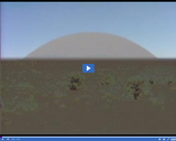
The significance of Laccoliths is discussed in this media item extracted from …
The significance of Laccoliths is discussed in this media item extracted from the 22-part video series THE GEOGRAPHY OF UTAH, conceived and written by Albert L. Fisher, PhD (University of Utah). The series encompasses the political, cultural, historical and sociological geography of the state of Utah. It describes the activities, the land and the people. Much of the video material was videotaped on location throughout the state of Utah, giving the student and interested viewer valuable field trip experiences. These mountains were formed by intrusive volcanism called laccoliths. Magma forced the earth's crust up into huge domes, similar to those shown in the graphic at the beginning of this video.
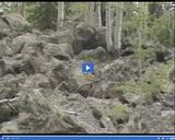
The significance of "Lava cap on Markagunt Plateau" is discussed in this …
The significance of "Lava cap on Markagunt Plateau" is discussed in this media item extracted from the 22-part video series THE GEOGRAPHY OF UTAH, conceived and written by Albert L. Fisher, PhD (University of Utah). The series encompasses the political, cultural, historical and sociological geography of the state of Utah. It describes the activities, the land and the people. Much of the video material was videotaped on location throughout the state of Utah, giving the student and interested viewer valuable field trip experiences. Markagunt is a Paiute word meaning "highland of trees."
A view of -- Mount Hillars; Henry Mountains -- is presented in …
A view of -- Mount Hillars; Henry Mountains -- is presented in this media item extracted from the 22-part video series THE GEOGRAPHY OF UTAH, conceived and written by Albert L. Fisher, PhD (University of Utah). The series encompasses the political, cultural, historical and sociological geography of the state of Utah. It describes the activities, the land and the people. Much of the video material was videotaped on location throughout the state of Utah, giving the student and interested viewer valuable field trip experiences. === Mount Hillars is a laccolith that stands at 10,650 feet. ===
A view of -- Mount Peale -- is presented in this media …
A view of -- Mount Peale -- is presented in this media item extracted from the 22-part video series THE GEOGRAPHY OF UTAH, conceived and written by Albert L. Fisher, PhD (University of Utah). The series encompasses the political, cultural, historical and sociological geography of the state of Utah. It describes the activities, the land and the people. Much of the video material was videotaped on location throughout the state of Utah, giving the student and interested viewer valuable field trip experiences. === Mount Peale, a laccolith, is 12,721 feet high. ===
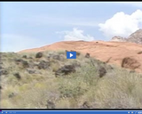
The significance of -- Lava cap in Snow Canyon -- is discussed …
The significance of -- Lava cap in Snow Canyon -- is discussed in this media item extracted from the 22-part video series THE GEOGRAPHY OF UTAH, conceived and written by Albert L. Fisher, PhD (University of Utah). The series encompasses the political, cultural, historical and sociological geography of the state of Utah. It describes the activities, the land and the people. Much of the video material was videotaped on location throughout the state of Utah, giving the student and interested viewer valuable field trip experiences.
The significance of -- Sandstone & volcanic debris, Snow Canyon -- is …
The significance of -- Sandstone & volcanic debris, Snow Canyon -- is discussed in this media item extracted from the 22-part video series THE GEOGRAPHY OF UTAH, conceived and written by Albert L. Fisher, PhD (University of Utah). The series encompasses the political, cultural, historical and sociological geography of the state of Utah. It describes the activities, the land and the people. Much of the video material was videotaped on location throughout the state of Utah, giving the student and interested viewer valuable field trip experiences.
The significance of -- Volcanic debris in Great Basin -- is discussed …
The significance of -- Volcanic debris in Great Basin -- is discussed in this media item extracted from the 22-part video series THE GEOGRAPHY OF UTAH, conceived and written by Albert L. Fisher, PhD (University of Utah). The series encompasses the political, cultural, historical and sociological geography of the state of Utah. It describes the activities, the land and the people. Much of the video material was videotaped on location throughout the state of Utah, giving the student and interested viewer valuable field trip experiences. === One thousand years ago, these areas were of vital importance to Native Americans who fashioned obsidian, or volcanic glass, into hunting weapons and tools. ===
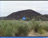
A view of -- Extinct volcano in Snow Canyon -- is presented …
A view of -- Extinct volcano in Snow Canyon -- is presented in this media item extracted from the 22-part video series THE GEOGRAPHY OF UTAH, conceived and written by Albert L. Fisher, PhD (University of Utah). The series encompasses the political, cultural, historical and sociological geography of the state of Utah. It describes the activities, the land and the people. Much of the video material was videotaped on location throughout the state of Utah, giving the student and interested viewer valuable field trip experiences. === Typical volcanic remains found in the Basin and Range physiographic province of Utah. ===
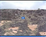
The significance of -- Lava cap and volcanic debris, Snow Canyon -- …
The significance of -- Lava cap and volcanic debris, Snow Canyon -- is discussed in this media item extracted from the 22-part video series THE GEOGRAPHY OF UTAH, conceived and written by Albert L. Fisher, PhD (University of Utah). The series encompasses the political, cultural, historical and sociological geography of the state of Utah. It describes the activities, the land and the people. Much of the video material was videotaped on location throughout the state of Utah, giving the student and interested viewer valuable field trip experiences.
No restrictions on your remixing, redistributing, or making derivative works. Give credit to the author, as required.
Your remixing, redistributing, or making derivatives works comes with some restrictions, including how it is shared.
Your redistributing comes with some restrictions. Do not remix or make derivative works.
Most restrictive license type. Prohibits most uses, sharing, and any changes.
Copyrighted materials, available under Fair Use and the TEACH Act for US-based educators, or other custom arrangements. Go to the resource provider to see their individual restrictions.